
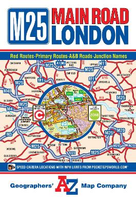
This A-Z Main Road Map of London is a full colour, fold-out map covering the Greater London area and extends beyond the M25 Motorway to: ‚ÄĘChesham ‚ÄĘSouth Mimms ‚ÄĘEpping ‚ÄĘBrentwood ‚ÄĘThurrock ‚ÄĘGravesend ‚ÄĘBorough Green ‚ÄĘSevenoaks ‚ÄĘRedhill ‚ÄĘGuildford ‚ÄĘWindsor ‚ÄĘBeaconsfield ‚ÄĘAmersham The mapping features motorways, primary routes, A & B roads and a selection of other main through routes showing road and junction names. Safety camera locations with their maximum speed limit, the central London congestion charging zone and the low emission zone boundary are also featured on the mapping. On the reverse of the map is the index which lists streets, place, area and junction names and selected places of interest that are featured on this map.
| ISBN: | 9781843487418 |
| Publication date: | 12th March 2015 |
| Author: | Geographers' A-Z Map Company |
| Publisher: | Geographers' A-Z Map Co Ltd an imprint of HarperCollins Publishers |
| Format: | Sheet map, folded |
| Pagination: | 1 pages |
| Series: | A-Z Road Map |
| Genres: |
Street maps and city plans Road atlases and maps Travel maps |