
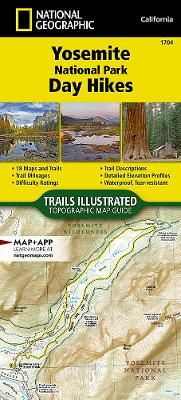
Waterproof, Tear-Resistant, Topographic Map. First protected in 1864 and designated as the third national park in 1890, Yosemite is home to countless natural icons including Yosemite Falls, the world's fifth tallest waterfall; El Capitan, one of the largest exposed monoliths of granite in the world; and Yosemite Valley and the Mariposa Grove of Giant Sequoias, which were the first scenic natural areas set aside by a national government for public benefit and appreciation. With so many spectacular historical, scientific and scenic resources and recreational opportunities that include backpacking, hiking, world-class climbing, fishing, camping and numerous winter pursuits, Yosemite has something for everyone. The Yosemite National Park Day Hikes Topographic Map Guide includes eighteen diverse hikes for all hiking enthusiasts, from the easy, 2.8 mile long Hetch Hetchy Valley Overlook to the strenuous, 14.7 mile long Laurel Lake Trail with 3,900' of elevation gain. Each hike has a detaile
| ISBN: | 9781566958035 |
| Publication date: | 17th January 2020 |
| Author: | National Geographic Maps |
| Publisher: | National Geographic Maps |
| Format: | Sheet map, folded |
| Pagination: | 48 pages |
| Genres: |
Travel maps and atlases Travel and holiday guides Travel guides: activity holidays Walking, hiking, trekking |