
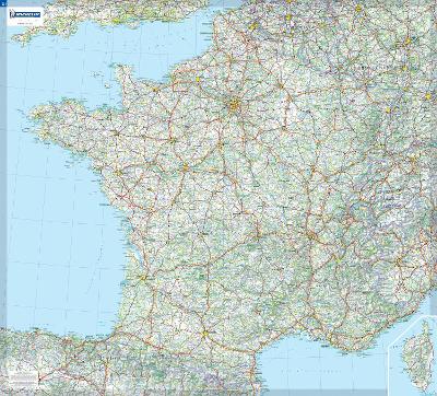
This wall map will give an overview of France's cities, adminstrative boundaries, as well as primary and secondary road network at a glance. This France laminated wall map, suitable to use with marker pens, is presented on a scale 1/1,000,000 and measures 100 x 111 cm. Our maps are regularly updated even if the ISBN does not change. (Edition updated in 2018)
| ISBN: | 9782067119857 |
| Publication date: | 19th June 2009 |
| Author: | Michelin |
| Publisher: | Michelin Editions des Voyages |
| Format: | Sheet map, rolled |
| Pagination: | 1 pages |
| Genres: |
Road atlases and maps |