
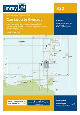
Imray-Iolaire charts for Caribbean are widely acknowledged as the best available for the cruising sailor. They combine the latest official survey data with first-hand information gathered over 60 years of research by Don Street Jr and his wide network of contributors. Like all Imray charts, they are printed on water resistant Pretex paper for durability, and they include many anchorages, facilities and inlets not included on official charts. Plans included: Tyrrel Bay (Carriacou) (1:17 500) Grenada Bay (1:30 000) Grenville Harbour (1:15 000) Grenada - Southeast Coast (1:45 000) Grenada - South Coast (1:40 000) Saint George's Harbour (1:12 500) On this edition, a new large scale plan of the South East coast of Grenada is included covering Great Bacolet Point to Marquis Point. New ranges and recommended courses are included and existing ones have been updated. The chart specification has been improved to show coloured light flashes. There has been general updating throughout.
| ISBN: | 9781786794161 |
| Publication date: | 31st October 2022 |
| Author: | Imray |
| Publisher: | Imray, Laurie, Norie & Wilson Ltd |
| Format: | Paperback |
| Pagination: | 1 pages |
| Series: | Lolaire |
| Genres: |
Sailing / yachting Navigation and seamanship |