

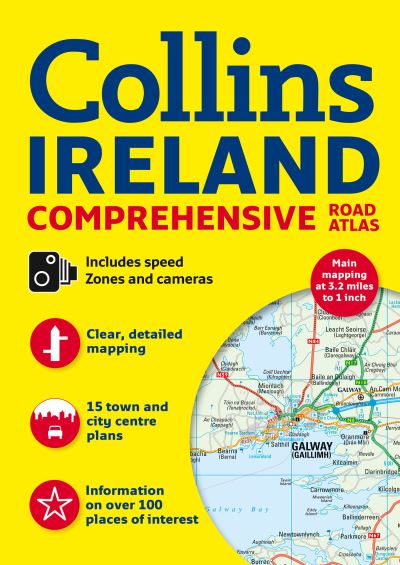
Clear, detailed road mapping of Ireland presented as an A4 format road atlas featuring attractive layer colouring to show land height. Speed enforcement zones are also shown on the mapping.
Along with the road mapping there is also a wide range of detailed town and city centre plans, all of which are fully indexed.
MAIN FEATURES
Detailed, general purpose road map of Ireland in a handy A4 format. Ideal for both business and pleasure use. The atlas contains a range of mapping scales:
9 miles to 1inch route planning map
Main maps at 3.2 miles to 1 inch whicha re ideal for navigation.
Plus a wide selection of detailed town centre street plans.
The 2009 edition includes the location of safety cameras and also Speed Enforcement Zones, which highlight roads that have a high risk of accidents as identified by the Garda and the National Roads Authority. Also new for 2009 is the addition of Blue Flag and Green Coast beaches, ideal for holiday makers. These have been evaluated for their water quality and safety, and, in the case of Blue Flag beaches, for their amenities such as life guards and toilets.
The main road mapping is packed with detail showing:
comprehensive colour classified road network.
toll roads clearly marked.
land height shown by the use of attractive layer colouring.
Tourist information centres and offices clearly shown.
wide range of tourist features plotted and categorized using symbols.
safety cameras and Speed Enforcement Zones.
Blue Flag and Green Coast beaches.
There is also a wide range of fully indexed town and city centre maps. These are:
Bangor, Belfast, Cork, Drogheda, Dublin, Dún Laoghaire, Galway, Kilkenny, Killarney, Limerick, Lisburn, Londonderry (Derry), Newry, Newtownabbey and Waterford.
There is also comprehensive guide information for visitors to Belfast, Cork, Dublin and Limerick.
WHO THE TITLE IS OF INTEREST TO
This is a general purpose map for those who want a high level of mapping detail at a variety of scales.
AREA OF COVERAGE
Covers the whole of the Republic of Ireland plus Northern Ireland.
| ISBN: | 9780007455201 |
| Publication date: | 1st March 2012 |
| Author: | Collins Maps |
| Publisher: | Collins an imprint of HarperCollins Publishers |
| Format: | Spiral bound |
| Pagination: | 160 pages |
| Genres: |
Road atlases and maps |
Clear, detailed road mapping of Ireland presented as an A4 format road atlas featuring attractive layer colouring to show land height. Speed enforcement zones are also shown on the mapping.
Along with the road mapping there is also a wide range of detailed town and city centre plans, all of which are fully indexed.
MAIN FEATURES
Detailed, general purpose road map of Ireland in a handy A4 format. Ideal for both business and pleasure use. The atlas contains a range of mapping scales:
9 miles to 1inch route planning map
Main maps at 3.2 miles to 1 inch whicha re ideal for navigation.
Plus a wide selection of detailed town centre street plans.
The 2009 edition includes the location of safety cameras and also Speed Enforcement Zones, which highlight roads that have a high risk of accidents as identified by the Garda and the National Roads Authority. Also new for 2009 is the addition of Blue Flag and Green Coast beaches, ideal for holiday makers. These have been evaluated for their water quality and safety, and, in the case of Blue Flag beaches, for their amenities such as life guards and toilets.
The main road mapping is packed with detail showing:
comprehensive colour classified road network.
toll roads clearly marked.
land height shown by the use of attractive layer colouring.
Tourist information centres and offices clearly shown.
wide range of tourist features plotted and categorized using symbols.
safety cameras and Speed Enforcement Zones.
Blue Flag and Green Coast beaches.
There is also a wide range of fully indexed town and city centre maps. These are:
Bangor, Belfast, Cork, Drogheda, Dublin, Dún Laoghaire, Galway, Kilkenny, Killarney, Limerick, Lisburn, Londonderry (Derry), Newry, Newtownabbey and Waterford.
There is also comprehensive guide information for visitors to Belfast, Cork, Dublin and Limerick.
WHO THE TITLE IS OF INTEREST TO
This is a general purpose map for those who want a high level of mapping detail at a variety of scales.
AREA OF COVERAGE
Covers the whole of the Republic of Ireland plus Northern Ireland.
Ireland Comprehensive Road Atlas features in the following genres: Road atlases and maps
Ireland Comprehensive Road Atlas is available in Spiral bound
Ireland Comprehensive Road Atlas was written by Collins Maps and published by Collins an imprint of HarperCollins Publishers
Ireland Comprehensive Road Atlas has 160 pages