
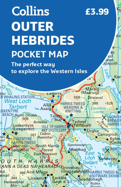
Explore new places with handy pocket maps from Collins.Handy little full-colour map of the Western Isles of Scotland. Detailed mapping and tourist information for the islands of Lewis, Harris, Uist, Benbecula, Barra and St Kilda. Excellent value and very detailed for its size.Famed for its stunning coastline, wildlife and traditional food and drink, the Outer Hebrides have a distinct identity. Discover these unique islands with this handy pocket map.Main features of this map include:Clear mapping at a scale of 3.2 miles to 1 inchTourist attractions located and describedSights, places to stay, cafe/restaurant, things to do are all highlighted on the mapTransport links map showing how to get to and depart the islandsIndex to places of interest and place namesEssential for those planning a trip around the Western Isles.
| ISBN: | 9780008580056 |
| Publication date: | 16th February 2023 |
| Author: | Collins Maps |
| Publisher: | Collins an imprint of HarperCollins Publishers |
| Format: | |
| Pagination: | 2 pages |
| Genres: |
Travel maps Road atlases and maps Islands Tourism geography Geographical maps: specialist / thematic maps Travel guides: routes and ways Places and peoples: general and pictorial works |
Explore new places with handy pocket maps from Collins.Handy little full-colour map of the Western Isles of Scotland. Detailed mapping and tourist information for the islands of Lewis, Harris, Uist, Benbecula, Barra and St Kilda. Excellent value and very detailed for its size.Famed for its stunning coastline, wildlife and traditional food and drink, the Outer Hebrides have a distinct identity. Discover these unique islands with this handy pocket map.Main features of this map include:Clear mapping at a scale of 3.2 miles to 1 inchTourist attractions located and describedSights, places to stay, cafe/restaurant, things to do are all highlighted on the mapTransport links map showing how to get to and depart the islandsIndex to places of interest and place namesEssential for those planning a trip around the Western Isles.
Outer Hebrides Pocket Map features in the following genres: Travel maps, Road atlases and maps, Islands, Tourism geography, Geographical maps: specialist / thematic maps, Travel guides: routes and ways, Places and peoples: general and pictorial works
Outer Hebrides Pocket Map is available in
Outer Hebrides Pocket Map was written by Collins Maps and published by Collins an imprint of HarperCollins Publishers
Outer Hebrides Pocket Map has 2 pages
£3.59